Activity

©
Tour du Gros-de-Vaud / Stage 4 from Etagnières to Froideville
The Tour du Gros-de-Vaud is a five-stage walking route, ideal for exploring the region. Around 70 kilometres long, this walking route is divided into five stages. It forms a loop around Echallens, passing through countryside, forests and rural villages. Following a variety of paths, it offers a comprehensive overview of the Gros-de-Vaud district and its heritage.
Stage 4: from Etagnières to Froideville
Distance: 9.4 km
Duration: approx. 2 hours 40 minutes Total ascent: 340 m Total descent: 170 m Highest point of the stage: 810 m Lowest point of the stage: 630 m
Etagnières The LEB railway line takes us to Etagnières station, the starting point of the fourth stage. A small family business has recently put this village on the map. The little Vaud pâtés, made by the Grossenbacher sisters, are an absolute must-try. Eleven years ago, the two sisters embarked on this adventure by reviving the production of this Vaud speciality. At the time, they perfected the recipe in their mother’s cellar. Made with top-quality ingredients, their pâtés are now internationally renowned. They also won the Pâté d’Or in 2010, as part of the ‘Semaine du Goût’ in Lausanne.
Morrens The path leading out of the forest takes us straight to the heights of Morrens. The Place de l’Orme offers an unobstructed view across the entire Jura range. In the centre of this square stands a magnificent ancient oak. With a trunk over two metres in diameter, this tree could tell us the whole history of the Gros-de-Vaud region. No doubt Major Davel, who grew up in this village, used to come here to admire this magnificent spot. A commemorative plaque on the façade of the Morrens vicarage reminds us that this man sacrificed his life for the independence of Vaud. Cugy On leaving Morrens, we join the Sentier du Talent, which we follow as far as Montheron Abbey. Halfway along the route, we pass the Moulin de Cugy, which sells a selection of regional produce.
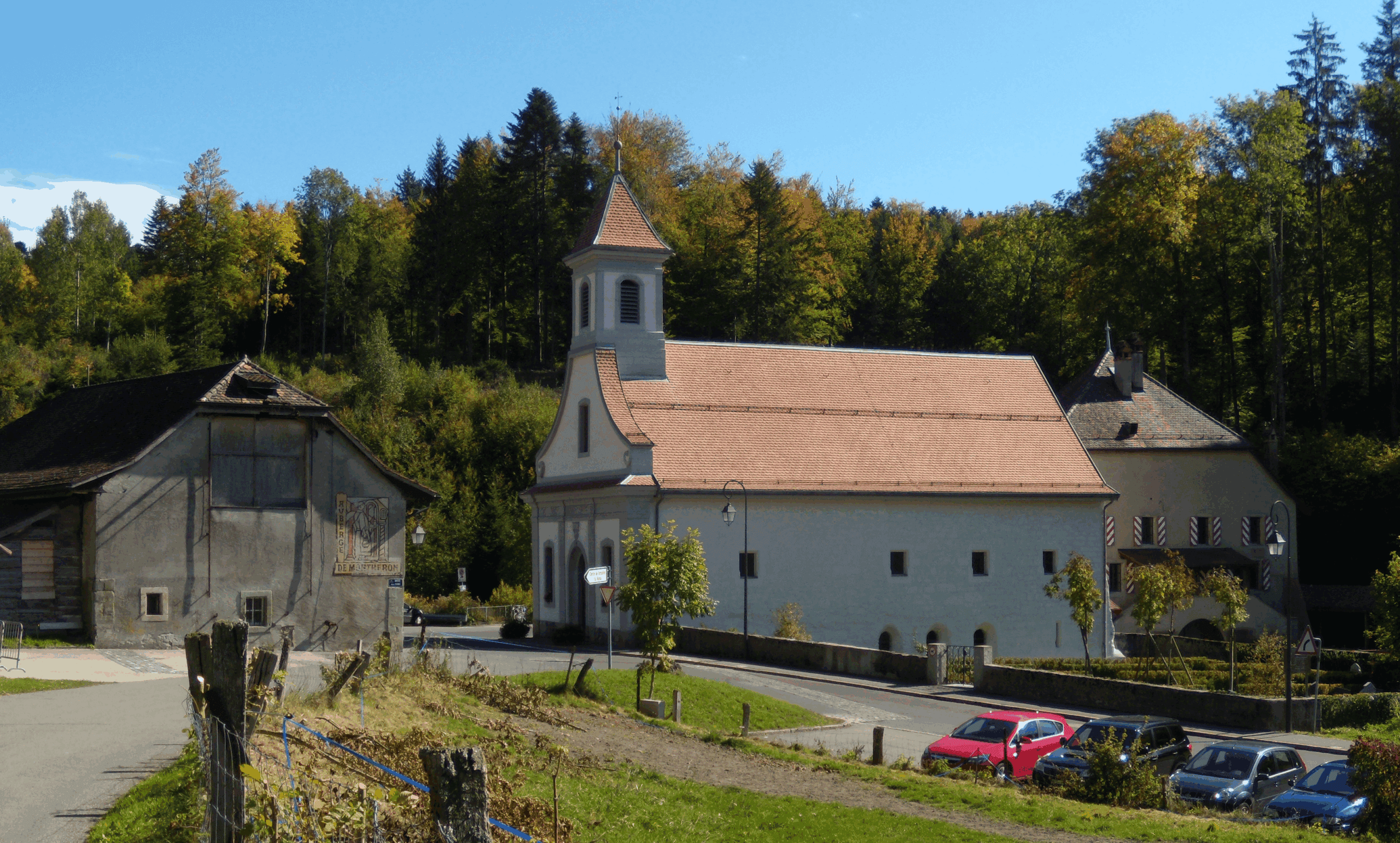
Montheron (municipality of Lausanne) This stage takes us past Montheron Abbey, built at the head of the valley carved out by the River Talent. The present church was built in the 17th century on the foundations of an ancient Romanesque church, constructed in the 12th century. That church had been destroyed during the Reformation in 1536.
Froideville The stage ends as we head up the valley carved out by the River Talent. Lovely forest paths lead us to the village of Froideville. The name of this village says it all. Exposed to the Bise wind and situated at an altitude of over 800 metres, winters here are harsh and snowfall is often heavy. It is the only village in the district where a cross-country ski trail is available in winter.
Routes created by Thierry Duperrut, qualified mountain guide. Email: thierry@montagne-rando.ch
. In collaboration with Echallens Région Tourisme
Link to Stage 1
Link to Stage 2
Link to Stage 3
Link to Stage 5